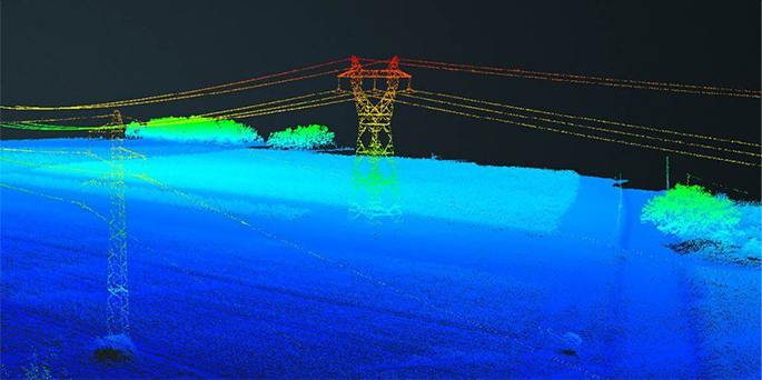

test til

In drone survey missions, the choice between photogrammetry and LIDAR depends heavily on the exact application. You also need to consider operational factors, such as cost and complexity. Knowing what outputs you really need will help you make the right decision.
We get a lot of questions about LIDAR sensors and their application to 3D surveys using drones. What is LIDAR and how does its output compare with results obtained with high-resolution RGB cameras and photogrammetry? In this article, we’ll explore the ways photogrammetry and LIDAR are actually quite different from each other, even if their three-dimensional (3D) outputs look similar. We’ll then dig deeper into specific applications and how photogrammetry can provide exceptional results for most missions at a fraction of the cost and complexity of LIDAR.
Photogrammetry and professional, high-resolution cameras can cost-effectively generate 2D and 3D surveys like this one, with absolute accuracies down to 1 cm (0.4 in) RMS horizontal and 3 cm (1.6 in) RMS vertical.
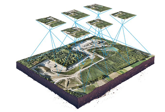
In photogrammetry, a drone captures a large number of high-resolution photos over an area. These images overlap such that the same point on the ground is visible in multiple photos and from different vantage points. In a similar way that the human brain uses information from both eyes to provide depth perception, photogrammetry uses these multiple vantage points in images to generate a 3D map.
The result: a high-resolution 3D reconstruction that contains not only elevation/height information, but also texture, shape, and color for every point on the map, enabling easier interpretation of the resulting 3D point cloud.
Drone systems that use photogrammetry are cost effective and provide outstanding flexibility in terms of where, when, and how you capture 2D and 3D data.
Photogrammetry combines images that contain the same point on the ground from multiple vantage points to yield detailed 2D and 3D maps.
We get a lot of questions about LIDAR sensors and their application to 3D surveys using drones. What is LIDAR and how does its output compare with results obtained with high-resolution RGB cameras and photogrammetry? In this article, we’ll explore the ways photogrammetry and LIDAR are actually quite different from each other, even if their three-dimensional (3D) outputs look similar. We’ll then dig deeper into specific applications and how photogrammetry can provide exceptional results for most missions at a fraction of the cost and complexity of LIDAR.
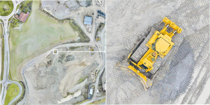
Photogrammetry and professional, high-resolution cameras can cost-effectively generate 2D and 3D surveys like this one, with absolute accuracies down to 1 cm (0.4 in) RMS horizontal and 3 cm (1.6 in) RMS vertical.
LIDAR, which stands for “light detection and ranging,” is a technology that has been around for many decades but has only recently been available in a size and power feasible for carrying on large drones. A LIDAR sensor sends out pulses of laser light and measures the exact time it takes for these pulses to return as they bounce from the ground. It also measures the intensity of that reflection.
LIDAR uses oscillating mirrors to send out laser pulses in many directions so as to generate a “sheet” of light as the drone moves forward. Through measuring the timing and intensity of the returning pulses, it can provide readings of the terrain and of points on the ground.
The sensor itself is only one part of a LIDAR system. Critically important for capturing usable data, you’ll also need a high-precision satellite positioning system (GNSS) as well as high-accuracy sensors to determine the orientation of the LIDAR sensor in space—an inertial measurement unit (IMU). All of these high-end subsystems must work in perfect orchestration to enable processing of the raw data into usable information, a process called direct geo-referencing.
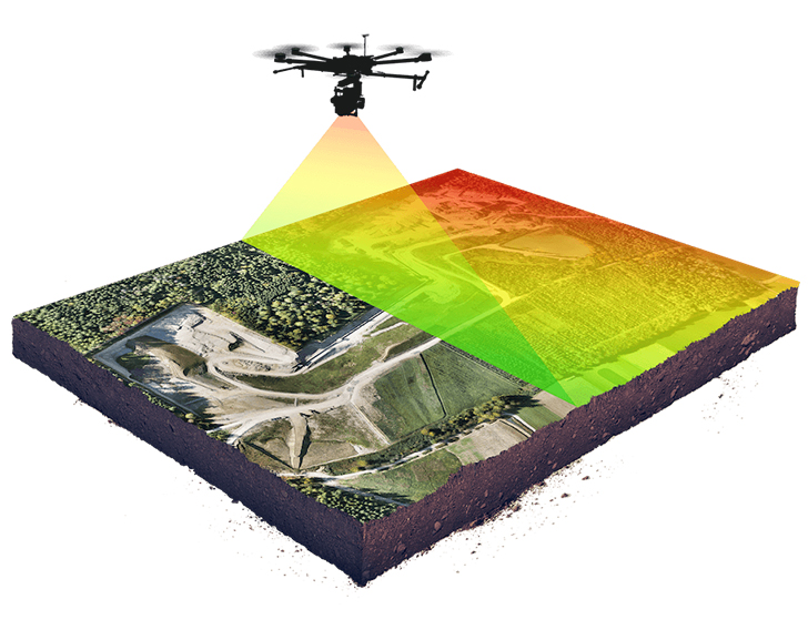
Classical airborne LIDAR surveys are conducted from a manned airplane and are less accurate but capable of covering more ground than lightweight UAV LIDAR operations. Specifically, you can cover between 10 and 1000 km2 (4 and 400 mi2) in one flight. The absolute accuracy depends on the flight height and sensor choice. At a typical flight height of 2000 m (6600 ft) above ground level (AGL), you can expect an absolute accuracy limit of about 20 cm (8 in) horizontal and 10 cm (4 in) vertical.
Lightweight drone LIDAR systems cover as much as the drone allows per flight. As we will discuss in detail in below sections, these systems can be more accurate than those carried by manned aircraft. Specifically, fixed-wing drones carrying a LIDAR payload can cover up to 10 km2 (4 mi2) in a flight, with absolute accuracy limits right around 10 cm (4 in) horizontal and 5 cm (2 in) vertical.
In both cases of manned aircraft and lightweight drone LIDAR, the accuracy is significantly less than photogrammetry avails. Plus the post-processing for LIDAR absolutely requires expertise beyond a quick training or reading of a manual, as we’ll discuss below.